Allaire
Alaer | |
|---|---|
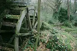 The Quip watermill | |
.svg.png.webp) Coat of arms | |
Location of Allaire | |
 Allaire  Allaire | |
| Coordinates: 47°38′16″N 2°09′42″W / 47.6378°N 2.1617°W | |
| Country | France |
| Region | Brittany |
| Department | Morbihan |
| Arrondissement | Vannes |
| Canton | Guer |
| Intercommunality | Redon Agglomération |
| Government | |
| • Mayor (2020–2026) | Jean-François Mary[1] |
| Area 1 | 41.74 km2 (16.12 sq mi) |
| Population | 3,875 |
| • Density | 93/km2 (240/sq mi) |
| Time zone | UTC+01:00 (CET) |
| • Summer (DST) | UTC+02:00 (CEST) |
| INSEE/Postal code | 56001 /56350 |
| Elevation | 1–88 m (3.3–288.7 ft) |
| 1 French Land Register data, which excludes lakes, ponds, glaciers > 1 km2 (0.386 sq mi or 247 acres) and river estuaries. | |
Allaire (French pronunciation: [alɛʁ] ⓘ; Breton: Alaer) is a commune in the Morbihan department in the Brittany region in northwestern France.
Geography
The river Arz forms most of the commune's northeastern border.
Population
Inhabitants of Allaire are called Allairiens.
| Year | Pop. | ±% p.a. |
|---|---|---|
| 1968 | 2,219 | — |
| 1975 | 2,394 | +1.09% |
| 1982 | 2,686 | +1.66% |
| 1990 | 2,990 | +1.35% |
| 1999 | 3,188 | +0.71% |
| 2007 | 3,528 | +1.27% |
| 2012 | 3,701 | +0.96% |
| 2017 | 3,854 | +0.81% |
| Source: INSEE[3] | ||
See also
References
- ↑ "Maires du Morbihan" (PDF). Préfecture du Morbihan. 7 July 2020.
- ↑ "Populations légales 2021". The National Institute of Statistics and Economic Studies. 28 December 2023.
- ↑ Population en historique depuis 1968, INSEE
External links
Wikimedia Commons has media related to Allaire (Morbihan).
- Official website

- Base Mérimée: Search for heritage in the commune, Ministère français de la Culture. (in French)
- Mayors of Morbihan Association (in French)
This article is issued from Wikipedia. The text is licensed under Creative Commons - Attribution - Sharealike. Additional terms may apply for the media files.