 The waters between Finger Point and Thumb Point near Cedar Springs, Beausoleil Island | |
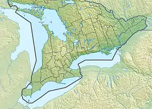 Beausoleil Island Location of the island in Southern Ontario | |
| Geography | |
|---|---|
| Location | Georgian Bay |
| Coordinates | 44°52′12″N 79°52′06″W / 44.87000°N 79.86833°W[1] |
| Archipelago | Thirty Thousand Islands |
| Length | 8 km (5 mi) |
| Administration | |
| Province | Ontario |
| District Municipality | District Municipality of Muskoka |
| Municipality | Georgian Bay |
| Additional information | |
| Time zone | |
| • Summer (DST) |
|
Beausoleil Island; Île Beausoleil; is an 8-kilometre (5.0 mi) long island in the municipality of Georgian Bay, District Municipality of Muskoka in Central Ontario, Canada.[1][2][3][4] The island is named after Louis Beausoleil, a Métis settler whose 1819 homestead stood at the island's southern tip.[5] The name of the island in the Huron-Wendat language is Skiondechiara which means "The land to appear floating afar".[6] The name of the island in the Anishinaabemowin language is variously Pamedenagog, Baamidoonegog or Epenmindaagoog meaning “rocky place floating about the mouth of a river”.[7] Located in the Thirty Thousand Islands in Georgian Bay on Lake Huron, it is the largest island in Georgian Bay Islands National Park and is the only place in the park where camping is allowed.[8] Beausoleil Island is also part of the Georgian Bay Littoral (also called the Georgian Bay Biosphere Reserve) UNESCO Biosphere reserve.[9]
Natural history
Beausoleil Island is a refuge for the Eastern Massasauga rattlesnake, the only snake in Ontario whose venom is potentially dangerous to humans.[10] On sunny days, Georgian Bay's cobalt waters form a striking counterpart to the light blue of the sky, the pinkish rocks of the Canadian Shield, and the dark green of the park's famous windswept pines.[11] The Fairy Lake and Cambrian Trails, in the north of the island, offer especially striking views of these natural features.
Northern Beausoleil Island's characteristic bedrock and wetland environment is rich in many species and is a major breeding area for amphibians, turtles and snakes. Southern Beausoleil Island's hardwood and mixed forests are good representations of regional woodland communities.[11]
History

Artifacts from as far back as the Middle Archaic period, 7,000 years ago, have been found, such as an Otter Creek projectile made from Onondaga chert. The remains of ancient pottery, tools, and hunting implements that have been found on Beausoleil have enabled archaeologists to determine that the island was, in all probability, used as a summer camp by early hunting and gathering cultures. These include primarily a Middle Woodland site occupied by the Point Peninsula and Saugeen groups (2,400-1,300 years ago), and the Algonkian speaking Odawa (or Ottawa) of the Late Woodland Period (600–400 years ago). Several other cultures have also left evidence of their occupation on the island.[12]
Descendants of the Chippewas of Lake Huron and Lake Simcoe settled on Beausoleil Island in 1842. The soil on the island proved to be unsuitable for cultivation, so the band moved to the Christian Islands which had been set aside as a reserve in the 1850s. On June 5, 1856 Beausoleil and all of the other islands in Georgian Bay, except the Christian Islands, were surrendered or sold to the British Crown. The Chippewa residents of Christian Islands still identify themselves as the Beausoleil First Nation.[13] The island was designated a National Historic Site of Canada in 2011.[14]
Summer Camps
Beausoleil Island has played a significant role in the birth of residential camping in Ontario. Beausoleil Island has been the home of 5 residential children's summer camps, all located on land leased from Parks Canada. These camps have included Camp Wabanaki (Kitchener-Waterloo YMCA, 1940-1970),[15] Camp Beausoleil (Toronto YMCA, 1931-1981)[16] and Camp Manitimono (Calvary Baptist Church, 1933-1994),[17][18] with two YMCA Camps remaining on the island: YMCA Camp Kitchikewana (YMCA of Simcoe Muskoka) founded by the Midland YMCA in 1919[19][20] and YMCA Camp Queen Elizabeth (YMCA of Western Ontario) originally the Sea Cadet Camp Queen Elizabeth (Royal Canadian Navy) established in 1942.[21][22] Former staffers at these last two camps went on to become great leaders in the Canadian camping movement: Winston "Smitty" Smith,[23][24] Jack Pearse,[24][25] Ron and Mickey Johnstone [26][27] among them. Camp Kitchikewana is one of the oldest camps in Ontario.[28]
Recreation
Beausoleil Island offers tent and cabin camping,[8] overnight and day docking, heritage education programs, and hiking trails.[29] Wheelchair accessible sites and reserved campsites are also available at the Cedar Spring campground.[8]
See also
References
- 1 2 "Beausoleil Island". Geographical Names Data Base. Natural Resources Canada. Retrieved 2010-07-27.
- ↑ "CLAIMaps IV". Ontario Ministry of Northern Development and Mines. 2016. Retrieved 2018-07-27.
- ↑ Map 5 (PDF) (Map). 1 : 700,000. Official road map of Ontario. Ministry of Transportation of Ontario. 2010-01-01. Retrieved 2018-07-27.
- ↑ Restructured municipalities - Ontario map #4 (Map). Restructuring Maps of Ontario. Ontario Ministry of Municipal Affairs and Housing. 2006. Archived from the original on 2018-06-26. Retrieved 2018-07-27.
- ↑ "HistoricPlaces.ca - HistoricPlaces.ca".
- ↑ "Civilization.ca - First Peoples of Canada - Naming the Land".
- ↑ "Parcs Canada | Parks Canada".
- 1 2 3 "Camping". Georgian Bay Islands National Park. Parks Canada. 2017-10-31. Retrieved 2018-07-27.
- ↑ "Georgian Bay Biosphere Reserve". Retrieved 2018-07-27.
- ↑ "Eastern Massasauga Rattlesnake - Georgian Bay Islands National Park". 30 July 2009.
- 1 2 "Natural heritage". Georgian Bay Islands National Park. Parks Canada. 2017-04-01. Retrieved 2018-07-27.
- ↑ Cultural Heritage (2005-06-01). "Georgian Bay Islands National Park of Canada - Natural Wonders & Cultural Treasures". Parks Canada.
- ↑ Beausoleil First Nation (2005). "Beausoleil First Nation - Historical Notes". Chiefs of Ontario. Archived from the original on 2006-05-16.
- ↑ Beausoleil Island. Directory of Federal Heritage Designations. Parks Canada. Retrieved 30 April 2012.
- ↑ 2014 75 Year Anniversary KW Cambridge Camp Wabanaki Alumni Photo Book
- ↑ https://davehoward.artstation.com/projects/bKBBAn
- ↑ https://www.facebook.com/Camp.Manitomono/
- ↑ "Research Notes: Herbert Sneyd Family Notes".
- ↑ 100th Anniversary Camp Kitchikewana 2019 Wall of Distinction Magazine
- ↑ "YMCA Camp Kitchikewana". YMCA of Simcoe/Muskoka. 2018. Retrieved 2018-07-27.
- ↑ "The Sea Cadet Years on Georgian Bay -by Bonnie G Rourke -Signed (Inc. Queen Elizabeth / Princess Alice Camps; Minnicognashene / Beausoleil Islands; HMCS Athabaskan; HMS Lion; HMCS Ottawa; etc)( 1942 - 1953 (Canadian Armed Forces / Navy League of Canada) by Rourke, Bonnie G (Signed); Foreword by Vice-Admiral (Retired) Gary Garnett / Huronia Museum Midland, Ontario - 2008".
- ↑ "Camp Queen Elizabeth". YMCA of Western Ontario. 2012. Retrieved 2018-07-27.
- ↑ "Honorary Life Members « Ontario Camps Association".
- 1 2 https://ymcaofsimcoemuskoka.ca/wp-content/uploads/2019/09/Wall-of-Distinction-Magazine-low-res-spread-pages.pdf
- ↑ "Jack Pearse Award - Canadian Camping Association – Summer Camps".
- ↑ "Vol 13 No 3 1961 April Canadian Camping Magazine". April 1961.
- ↑ "Ron Johnstone Award - Canadian Camping Association – Summer Camps".
- ↑ https://www.gottarent.com/community-story/6869129-almost-a-century-s-worth-of-camp-kitchi-traditions-on-beausoleil-island/
- ↑ "Activities". Georgian Bay Islands National Park. Parks Canada. 2017-04-01. Retrieved 2018-07-27.
National Historic Sites of Canada by location | |
|---|---|
| Provinces | |
| Territories | |
| Other countries | |
| |