| Shigar River | |
|---|---|
.JPG.webp) Shigar river at Shigar Fort | |
  | |
| Location | |
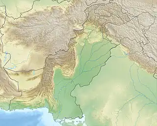
| Country | Pakistan |
| Province | Gilgit-Baltistan |
| Physical characteristics | |
| Mouth | |
• location | Indus River |
• coordinates | 35°19′52″N 75°38′0″E / 35.33111°N 75.63333°E |
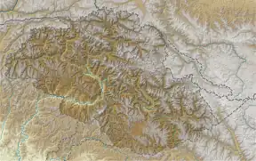
Shigar River (Urdu: دریائے شگر) is located in the mountainous Baltistan region of northern Pakistan. The Shigar River is formed from the melted water of the Baltoro Glacier and Biafo Glacier. It flows through the Shigar Valley. The river is a tributary to the Indus River and meets the Indus in Skardu Valley.[1]
References
- ↑ "Indus River | Definition, Length, Map, History, & Facts". Encyclopedia Britannica. Retrieved 2020-11-25.
External links
![]() Media related to Shigar River at Wikimedia Commons
35°19′52″N 75°38′0″E / 35.33111°N 75.63333°E
Media related to Shigar River at Wikimedia Commons
35°19′52″N 75°38′0″E / 35.33111°N 75.63333°E
This article is issued from Wikipedia. The text is licensed under Creative Commons - Attribution - Sharealike. Additional terms may apply for the media files.