Thise | |
|---|---|
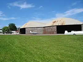 The Besançon-Thise Aerodrome in Thise | |
.svg.png.webp) Coat of arms | |
Location of Thise | |
 Thise 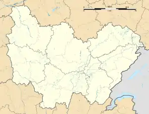 Thise | |
| Coordinates: 47°17′00″N 6°05′00″E / 47.2833°N 6.0833°E | |
| Country | France |
| Region | Bourgogne-Franche-Comté |
| Department | Doubs |
| Arrondissement | Besançon |
| Canton | Besançon-4 |
| Intercommunality | Grand Besançon Métropole |
| Government | |
| • Mayor (2022–2026) | Pascal Dériot[1] |
| Area 1 | 8.93 km2 (3.45 sq mi) |
| Population | 3,000 |
| • Density | 340/km2 (870/sq mi) |
| Time zone | UTC+01:00 (CET) |
| • Summer (DST) | UTC+02:00 (CEST) |
| INSEE/Postal code | 25560 /25220 |
| Elevation | 244–422 m (801–1,385 ft) |
| 1 French Land Register data, which excludes lakes, ponds, glaciers > 1 km2 (0.386 sq mi or 247 acres) and river estuaries. | |
Thise (French pronunciation: [tiz]) is a commune in the Doubs department in the Bourgogne-Franche-Comté region in eastern France.
Geography
Thise lies 9 km (5.6 mi) southwest of Marchaux.
Population
| Year | Pop. | ±% p.a. |
|---|---|---|
| 1968 | 1,000 | — |
| 1975 | 1,615 | +7.09% |
| 1982 | 2,554 | +6.77% |
| 1990 | 2,856 | +1.41% |
| 1999 | 3,036 | +0.68% |
| 2007 | 3,202 | +0.67% |
| 2012 | 3,157 | −0.28% |
| 2017 | 3,044 | −0.73% |
| Source: INSEE[3] | ||
See also
References
- ↑ "Répertoire national des élus: les maires" (in French). data.gouv.fr, Plateforme ouverte des données publiques françaises. 6 June 2023.
- ↑ "Populations légales 2021". The National Institute of Statistics and Economic Studies. 28 December 2023.
- ↑ Population en historique depuis 1968, INSEE
External links
Wikimedia Commons has media related to Thise.
- Thise on the regional Web site (in French)
- Official website (in French)
This article is issued from Wikipedia. The text is licensed under Creative Commons - Attribution - Sharealike. Additional terms may apply for the media files.